Cap de Formentor
Port de PollençaModerateTested by a local
Why Moderate?
- 870 m of climbing: 300 m or more, but under 900 m
- No single climb of 600 m or more
≈41.2 km · 21 m/km · longest climb 220 m, 7.1 km at 3.1 %
 Gran Café 1919Practical stop · km ≈1Open ›
 Holibikes Tours & CoffeeSpecialty coffee · km ≈1Open ›
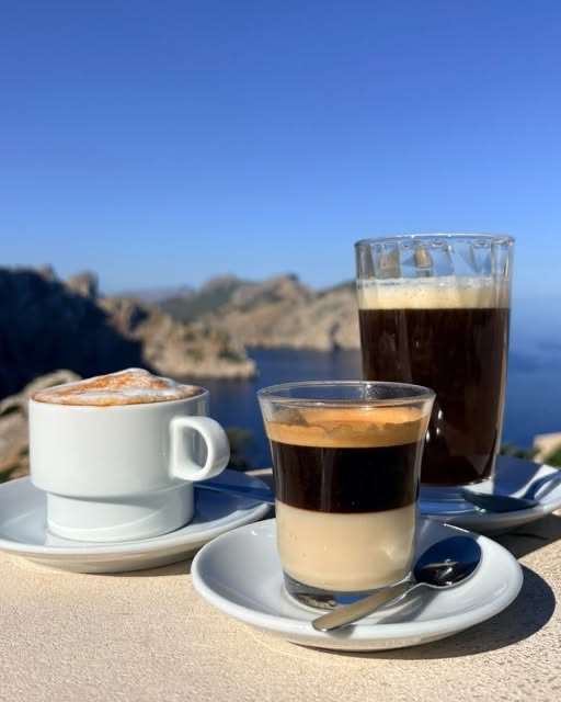 Formentor lighthouse caféPractical stop · km ≈21Open ›
- Specialty coffee
- Practical stop
- Start
- Finish
- Specialty coffee
- Practical stop
A guide for planning, not a guarantee: check conditions and ride at your own risk. Terms and disclaimer


- Distance ≈
- 41.2 km
- Climbing ≈
- 870 m
About 3 h of riding at a relaxed pace (25 km/h on the flat and 700 m of climbing an hour), not counting stops.
for you at a steady pace, not counting stops. How we estimate
How we estimate your time
Your time comes from a physics model: your weight plus 8 kg for bike and kit, and a share of your FTP held for the whole ride (Easy 55 %, Steady 65 %, Fast 75 %). The rest are assumptions, not measurements: rolling resistance 0.005, drag area 0.32 m² (hands on the hoods), air density 1.2 kg/m³ and 97 % of your power reaching the wheel.
Each route is measured every 0.2 km along its GPX. Descents never count faster than 45 km/h: a cap for the estimate, not a speed to aim for. Stops, wind, heat and traffic are not included, and times are rounded to 5 minutes.
Don't know your FTP? Each level stands for the FTP that holds its speed on the flat at a Steady pace (75 kg rider):
- Relaxed: ≈22 km/h, FTP ≈109 W
- Fit: ≈27 km/h, FTP ≈177 W
- Strong: ≈32 km/h, FTP ≈271 W
These are estimates to help you plan, not medical or safety advice. Ride within your limits.
Today on this route
Heat on your ride today
Forecast by hour from Open-Meteo at the start, about 6.5 °C cooler for every 1,000 m you climb (a standard assumption; sea breezes and calm mornings can differ).
Weather data by Open-Meteo.com (CC BY 4.0). "Start by" allows 30 min for coffee and 30 min to spare. Our pick, not a safety guarantee.
Good to know
- An out-and-back on the Ma-2210: to the lighthouse at the tip of the island, then back the same way.
- The return has its own climbs: about 520 m of climbing on the way out and 360 m on the way back. Keep something in the legs for the second half.
- The road is narrow in places and the cape is exposed, so check the wind before you go and take care on the descents.
- On the way out you ride through a tunnel of about 300 m, just before the highest point at km 17.2.
- Bring water and food. The lighthouse is a natural place for a break: Formentor lighthouse café
Km by km
Coffee on the way3 stops
3 coffee stops on 41.2 km: Gran Café 1919 at km 1, Holibikes Tours & Coffee at km 1, Formentor lighthouse café at km 21.
- km 0StartPort de Pollença
- km ≈1Gran Café 1919Practical stop · tested by a local
- km ≈1Holibikes Tours & CoffeeSpecialty coffee · from the web
- km ≈7Top of the first climbJust over 200 m, with the bay of Pollença below
- km ≈10Formentor beachThe road drops almost to sea level, then climbs along the cape
- km ≈17Highest point on the way out, ≈220 mAfter a tunnel of about 300 m
- km ≈21Formentor lighthouse caféPractical stop · tested by a local
- km ≈21Turn around at the lighthouseSame road back, with about 360 m of climbing
- km 41.2FinishBack in Port de Pollença
Compare with…
More rides like this
We're adding more routes and checking more coffee stops on the bike. Get an email when new ones are ready.
No spam. Unsubscribe any time. How we use your email
About this ride
The ride to the lighthouse at Cap de Formentor is the classic out-and-back of the north coast. It starts on the seafront at Port de Pollença and follows the Ma-2210 to the very tip of the island, then comes back the same way.
The first climb starts almost straight away. It rises for about 6.7 km at a gentle 3 % average to a high point of just over 200 m, with the bay of Pollença opening up below. The road then drops towards Formentor beach and climbs again along the spine of the cape, through a tunnel of about 300 m, up to the highest point of the day at around 220 m. The last kilometres roll up and down to the lighthouse, about 21 km from the start.
Because it is an out-and-back, the return has its own climbs: about 520 m of climbing on the way out and 360 m on the way back. None of it is steep, but it adds up, so keep something in the legs for the second half.
The road is narrow in places and the cape is exposed, so check the wind before you go and take care on the descents. Bring water and food, and treat the turnaround at the lighthouse as a natural place for a break before heading back to Port de Pollença.
Questions
How long is the Cap de Formentor ride?
41.2 km with about 870 m of climbing. It starts on the seafront at Port de Pollença, follows the Ma-2210 to the lighthouse at the tip of the island and comes back the same way.
How hard are the climbs?
None of it is steep, but it adds up. The first climb rises for about 6.7 km at a gentle 3 % average to just over 200 m, and the highest point of the day is around 220 m. There is about 520 m of climbing on the way out and 360 m on the way back.
What should I know about the wind and the tunnel?
The cape is exposed and the road is narrow in places, so check the wind before you go and take care on the descents. On the way out you ride through a tunnel of about 300 m, just before the highest point at km 17.2.
Where can I stop for coffee?
This route has three coffee stops: Gran Café 1919 and Holibikes Tours & Coffee in Port de Pollença, and the Formentor lighthouse café at the turnaround.
Renting a bike in the north? What to ask the shop, and two shops we'd point you to ›
Map data © OpenStreetMap contributors. Elevation: MDT05 ©Instituto Geográfico Nacional (CC BY 4.0).
Got the GPX. Want the next ones?
We'll email you when we add new routes and coffee stops.
No spam. Unsubscribe any time. How we use your email