Bay of Alcúdia
Port d'AlcúdiaEasyTested by a local
Why Easy?
- 160 m of climbing and 41.9 km: under 300 m and up to 50 km
≈41.9 km · 4 m/km · longest climb 40 m, 16.7 km at 0.2 %
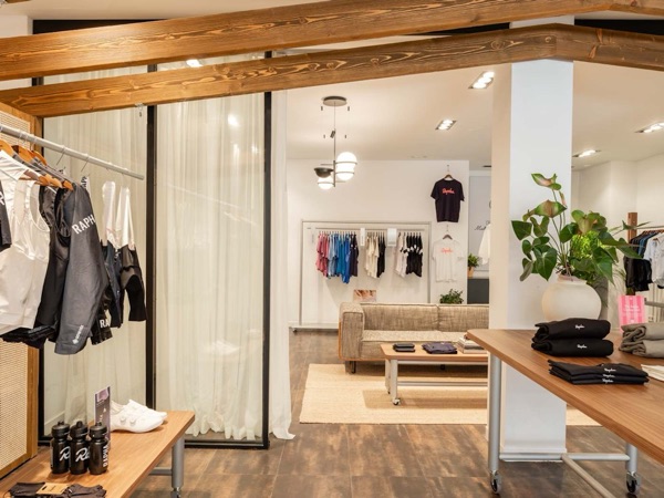 Rapha Mallorca North Pop-upSpecialty coffee · km 0Open ›
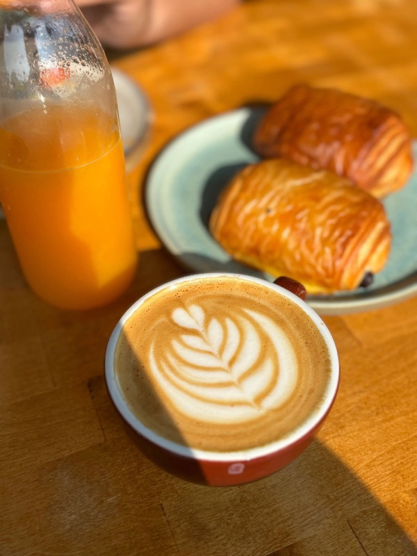 L'EpicerieSpecialty coffee · km ≈3Open ›
 Your ChoiceSpecialty coffee · km ≈11Open ›
- Specialty coffee
- Start
- Finish
- Specialty coffee
A guide for planning, not a guarantee: check conditions and ride at your own risk. Terms and disclaimer


- Distance ≈
- 41.9 km
- Climbing ≈
- 160 m
About 2 h of riding at a relaxed pace (25 km/h on the flat and 700 m of climbing an hour), not counting stops.
for you at a steady pace, not counting stops. How we estimate
How we estimate your time
Your time comes from a physics model: your weight plus 8 kg for bike and kit, and a share of your FTP held for the whole ride (Easy 55 %, Steady 65 %, Fast 75 %). The rest are assumptions, not measurements: rolling resistance 0.005, drag area 0.32 m² (hands on the hoods), air density 1.2 kg/m³ and 97 % of your power reaching the wheel.
Each route is measured every 0.2 km along its GPX. Descents never count faster than 45 km/h: a cap for the estimate, not a speed to aim for. Stops, wind, heat and traffic are not included, and times are rounded to 5 minutes.
Don't know your FTP? Each level stands for the FTP that holds its speed on the flat at a Steady pace (75 kg rider):
- Relaxed: ≈22 km/h, FTP ≈109 W
- Fit: ≈27 km/h, FTP ≈177 W
- Strong: ≈32 km/h, FTP ≈271 W
These are estimates to help you plan, not medical or safety advice. Ride within your limits.
Today on this route
Heat on your ride today
Forecast by hour from Open-Meteo at the start, about 6.5 °C cooler for every 1,000 m you climb (a standard assumption; sea breezes and calm mornings can differ).
Weather data by Open-Meteo.com (CC BY 4.0). "Start by" allows 30 min for coffee and 30 min to spare. Our pick, not a safety guarantee.
Km by km
Coffee on the way3 stops
3 coffee stops on 41.9 km: Rapha Mallorca North Pop-up at km 0, L'Epicerie at km 3, Your Choice at km 11.
- km 0StartPort d'Alcúdia
- km 0Rapha Mallorca North Pop-upSpecialty coffee · from the web
- km ≈3L'EpicerieSpecialty coffee · tested by a local
- km ≈11Your ChoiceSpecialty coffee · tested by a local
- km 41.9FinishBack in Port d'Alcúdia
More rides like this
We're adding more routes and checking more coffee stops on the bike. Get an email when new ones are ready.
No spam. Unsubscribe any time. How we use your email
About this ride
The easiest ride on this site: an almost flat out-and-back along the Bay of Alcúdia, from Port d’Alcúdia to Son Serra de Marina. It works for a first day on the island, a recovery day, or riding with someone less used to the bike.
The route starts near Rapha’s pop-up in Port d’Alcúdia and follows the road behind the beaches round the bay. L’Epicerie, with its specialty coffee and bakery, is after about 3.5 km, and Your Choice in Can Picafort after 11 km.
After Can Picafort the road leaves the hotels behind and rolls gently through the countryside to Son Serra de Marina, the only part with any climbing at all. Then you turn round and ride back the same way: 42 km and about 160 m of climbing in all.
The local behind this site has ridden it. The track is drawn along OpenStreetMap roads, with elevations from the official Spanish terrain model.
Renting a bike in the north? What to ask the shop, and two shops we'd point you to ›
Map data © OpenStreetMap contributors. Elevation: MDT05 ©Instituto Geográfico Nacional (CC BY 4.0).
Got the GPX. Want the next ones?
We'll email you when we add new routes and coffee stops.
No spam. Unsubscribe any time. How we use your email