Coll de Sóller
SóllerFrom the web · not yet verified

- Distance ≈
- 17 km
- Climbing ≈
- 490 m
- Climb time
- Your time ›
Coffee stops
About this ride
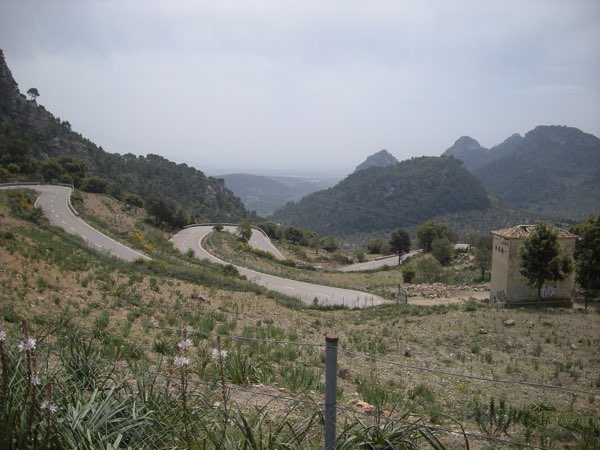
The old road over the Coll de Sóller is one of the most enjoyable climbs in Mallorca: a narrow ribbon of tarmac that winds up the mountain in a long series of hairpins. Most traffic between Palma and Sóller now uses the tunnel underneath, which leaves the pass road to cyclists and a few cars.
This route starts in Sóller and climbs about 8.5 km to the col at roughly 500 m, gaining around 460 m. The gradient is very even: almost every kilometre sits between 5 and 6.5 %, so you can find a rhythm and hold it to the top.
At the col, Can Topa is the obvious place to stop. From there the road drops down the other side to Bunyola, where the route ends after 16.5 km. It is a point-to-point ride, so plan how you will get back, or turn around at the top and enjoy the hairpins in reverse.
Take care on the descent: the corners are tight and you will not see oncoming traffic until it is close.
The figures on this page come from OpenStreetMap and the official Spanish terrain model, not yet from a ride by a local.
Map data © OpenStreetMap contributors. Elevation: MDT05 ©Instituto Geográfico Nacional (CC BY 4.0).